 |
The Waynflete Wire |
K-1 village project
In K-1, we have extended our Identity and Expression unit into conversations about the geography of where we live. We read books and drew maps of our rooms and of our K-1 space, and began a project where we drew pictures about the many places we live—starting small and getting bigger. Our first smallest circle was ourselves, then our house, our town, our state, our country, and finally our continent. We have put maps of our state, country, and world up in the classroom for students to explore.
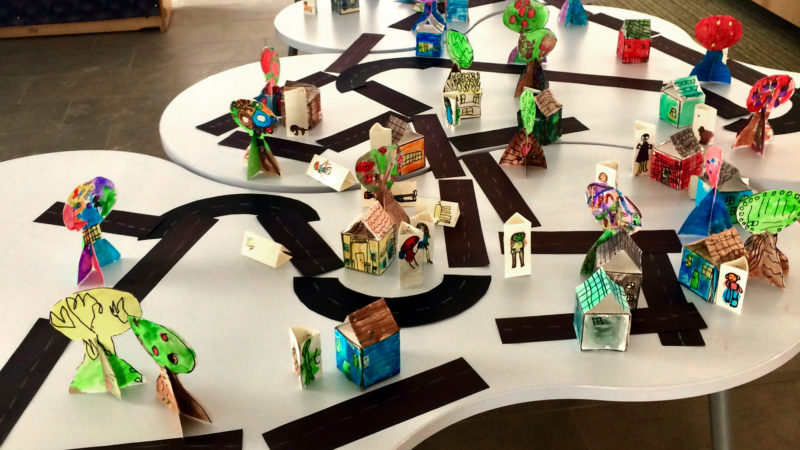
During the first two weeks of our study, we focused on our houses and our community. We drew small houses labeled with our street name and house number, then grouped them by town on the wall in our classroom. We also collaborated with Art Teacher Mary Rehak to create a 3D version of our map. Each student made a 3D house, tree, and a trifold of people and/or pets. We placed these on a large table configuration in our shared space to create a K-1 village. Students have moved the roads, houses, and people to create their own town.